Tidbinbilla Nature Reserve: A Brief Guide

Tidbinbilla has something for everyone: from rugged peaks to rolling grasslands; from ancient rock shelters to cascading creeks; from whispering forests to wetlands teeming with wildlife.
Download the Tidbinbilla Nature Reserve: A Brief Guide (PDF 2.7 MB) to plan your visit.
Walking on trails
Tidbinbilla Nature Reserve has 24 signposted walks that will take you beyond the main roads and picnic areas. Meander through the Sanctuary wetlands, find a koala in the Eucalypt Forest, or take a full day hike to the top of the Tidbinbilla Range. Whether you like a short gentle stroll or challenging long walks, Tidbinbilla has something to suit your sense of adventure and abilities.
Walking off-track
Well prepared walkers who venture into the mountains surrounding Tidbinbilla Valley reap some of the reserve's greatest rewards. When tackling an off-track walk, please ensure you have the fitness, experience, equipment and navigational skills to do it safely. As there is no overnight camping at Tidbinbilla Nature Reserve, you must be able to return from your adventure and exit the reserve before closing time. As most areas of Tidbinbilla have no mobile reception, rescue attempts can be extremely challenging and may be at your cost.
Please remember:
- Parks and reserves are natural environments that can be unpredictable. To reduce risks and stay safe, refer to our safety tips.
- Come with clean equipment – your vehicle, bicycle, or equipment such as hiking boots or walking poles, can all carry in unwanted weeds or pathogens that impact our natural environment. Please ensure you arrive with clean equipment.
Icon key
- 1Trail number and colour (as per trail map, guide and onsite signage)
 Trail grade
 Cycling permitted
 Wheelchair accessible (with assistance)
 Heritage and culture - Aboriginal
 European heritage
Birrigai Time Trail
3km loop - 1 hour

Learn about the rich culture and history of the Ngunnawal people at the oldest known rock shelter in the Alps region, used by the Ngunnawal people for tens of thousands of years. As you return through the open grasslands to the Visitor Centre, consider the cultural land management practices used by the First Peoples to care for Country over generations. The walk also includes insights into the life of early European settlers in this valley. Suitable for most ages and fitness levels. Some bushwalking experience is recommended. The track has short steep hill sections, a rough surface and many steps.
This walk starts at the Visitor Centre.
Please be mindful that Birrigai Rock Shelter is a highly significant cultural site for the Ngunnawal Traditional Custodians. The Elders ask that you respectfully visit this place by staying on the marked track, taking only memories and leaving only footprints.

Sheedys Link
1km one-way - 30 mins

Grazing kangaroos and colourful rosellas are highlights along this short, easy trail through the Tidbinbilla Valley floor. Enjoy the contrasting woodlands and open grasslands as this trail links the Visitor Centre to Sheedys picnic area and the Nature Discovery Playground. If you are keen for a longer walk, you can continue around the Congwarra Trail, a 3.1km loop that winds its way through shrubland and along the Tidbinbilla River as it crosses through four picnic areas. No bushwalking experience is required. The track has gentle hill sections.
This link track starts at the Visitor Centre.

Congwarra Trail
3.1km loop - 1 hour
This walk is named after a Ngunnawal warrior who lived in the 19th century. Walk or cycle along the Tidbinbilla River, through shrubland and open grassland while listening to an array of birdsong. No bushwalking experience required. The track is a compacted surface with gentle hills and some rocky sections.
This loop trail starts at Webbs, Greens, Blewitts or Sheedys picnic areas.
The Congwarra Trail video offers a close look at the walking track so you can decide if it suits your needs. See the terrain, path conditions, and natural surroundings to help you plan your visit with confidence.

Dalsetta Link
600m one-way - 15 mins
The Dalsetta Link is a short trail that joins Dalsetta to the Congwarra Trail through open forest. It is an easy walk or short ride. For a longer walk, you can continue around the 3.1km Congwarra Trail. No bushwalking experience is required. The track has gentle hill sections.
This walk starts at Dalsetta carpark.

Turkey Hill Trail
500m loop - 15 mins
Take a short stroll up and around Turkey Hill. This walk highlights the amazing geology of the local area. Enjoy the stunning views of the Tidbinbilla Range as you make your way through the many granite tors rising from the local grasslands. Kangaroos are a common sight on Turkey Hill as they graze peacefully. No bushwalking experience is required. The track has gentle hill sections.
This walk begins at Dalsetta carpark.

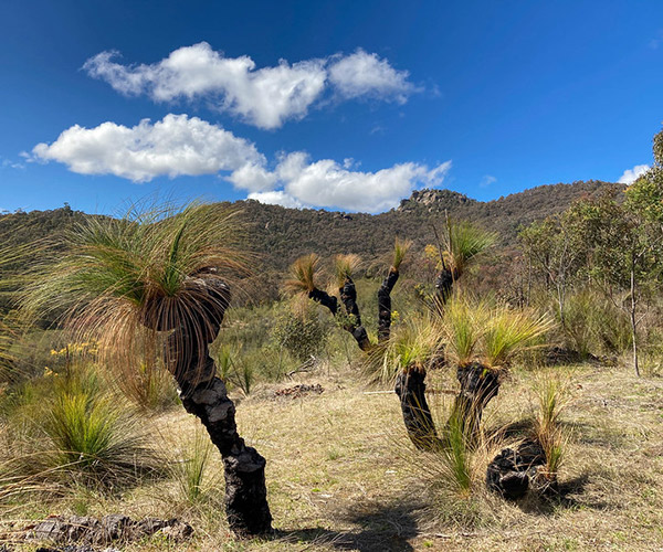
Wandarawari Track
2.2km return - 45 mins
Wandarawari means 'place of warriors' in Ngunnawal language. Walk this loop trail to understand more about this special place, the grass trees and their long-standing connection with the Ngunnawal people. The high point of this walk is the magnificent stand of grass trees sitting under Gibraltar Peak. Here, you can learn about the importance of cultural burning for Country and its First Peoples as you take in amazing views. No bushwalking experience is required. The track has gentle hill sections and occasional steps.
This walk starts from Dalsetta carpark.
Please be mindful that Wandarawari/grass tree site is a significant cultural site for the Ngunnawal Traditional Custodians. The Elders ask that you respectfully visit this place by staying on the marked track, taking only memories and leaving only footprints.
The Wandarawari Track video offers a close look at the walking track so you can decide if it suits your needs. See the terrain, path conditions, and natural surroundings to help you plan your visit with confidence.
Church Rock Heritage Loop
2.5km loop - 1 hour
Follow the footsteps of the early pioneers on this signed heritage walk through Flints homestead site and around Church Rock. Discover great views and stories of early European settler experiences. Suitable for most ages and fitness levels. Some bushwalking experience recommended. The track has short steep hill sections, a rough surface and many steps.
This walk starts at Flints picnic area.
The Church Rock Heritage Loop video offers a close look at the walking track so you can decide if it suits your needs. See the terrain, path conditions, and natural surroundings to help you plan your visit with confidence.

Barayngu Murawung
1km loop - 15 mins
Barayngu Murawung means 'wallaby's path' in Ngunnawal language. Stroll through open woodland and around a large rocky knoll. Take your time to scan the rocks as this walk through one of our predator-proof breeding enclosures is the most likely place to see our ACT mammal emblem, the threatened Southern Brush-tailed Rock-wallaby. No bushwalking experience required. The track is a compacted surface and has gentle hill sections and occasional steps.
This walk starts at Black Flats carpark.

Black Flats Dam
600m return - 15 mins
This short walk crosses the Tidbinbilla River and passes through a small section of forest before arriving at tranquil Black Flats Dam. A quiet rest by the water's edge may be rewarded by the appearance of shy platypus and turtles. This walk can be used to enter the Sanctuary via the Black Flats link trail. No bushwalking experience required. The track is a hardened or compacted surface and has a gentle hill section.
This walk begins at Black Flats carpark.

Sanctuary Loop
2.1km loop - 30 mins
The Sanctuary is a wetlands ecosystem, surrounded by bushland and protected by a predator-proof fence. It provides refuge for a range of native species. Wind your way along a mix of wheelchair-friendly walking trails and boardwalks that link the ponds. You may encounter platypus, turtles, bandicoots and a huge variety of birds. No bushwalking experience required. The track is a flat, even surface with no steps or steep sections.
This walk can start at either the Sanctuary carpark or Ribbon Gum carpark.
Suitable for wheelchair users who have someone to assist them.

Koala Path
700m loop - 20 mins
This short walk takes you through the Eucalypt Forest, a predator-proof enclosure that houses our koalas. At the start of the path is a smaller enclosure, where you can see these enchanting marsupials up close. Wander the Koala Path and look for other free-ranging koalas among the gum trees, as well as potoroos and wallabies. No bushwalking experience required. Flat, even surface with no steps.
Please note: There are some steeper gradients. It is recommended that wheelchair users have someone to assist them.

Koala Path/Peppermint Trail
1.8km loop - 30 mins
This easy walk crosses over Mountain Creek and continues around the Eucalypt Forest, a predator-proof enclosure that houses our koalas. It is a perfect spot to search for koalas, wallabies, potoroos and forest birds. No bushwalking experience required. The track is a hardened or compacted surface and has gentle hill sections.
This walk starts at the Eucalypt Forest carpark.
The Koala Path/Peppermint Trail video offers a close look at the walking track so you can decide if it suits your needs. See the terrain, path conditions, and natural surroundings to help you plan your visit with confidence.

Cascades Trail
2km/2.6km loop - 40-60 mins
This shady forest walk is a great escape on a hot day, and equally beautiful on a cool wet day. See the subtle changes in understorey as you meander through forest, shaded vales and wet gullies. Let your senses savour the sights, sounds and smells of the bush. If you're lucky, you might catch a glimpse of a wallaby or hear a lyrebird sing. The full walk (2.6km) includes a steep climb, and you are rewarded for your effort with arrival at the main falls, where clear water cascades between granite tors. For a flatter option take the 'shortcut' and complete the shorter (2km) but still beautiful lower loop. Suitable for most ages and fitness levels. Some bushwalking experience recommended. The track has short steep hill sections, a rough surface and many steps.
This walk starts from the Mountain Creek carpark.

Hanging Rock
500m loop - 15 mins
This walk crosses Ashbrook Creek and passes through tall wet eucalyptus forest, before climbing up to Hanging Rock, a large granite tor that is one of many ancient rock shelter sites utilised by the Ngunnawal people within Tidbinbilla Valley. Hanging Rock Shelter is a highly significant place, culturally and spiritually, to the Ngunnawal people, so please tread gently. Keep your eye out for swamp wallabies as the trail loops around the shelter and returns to the carpark. No bushwalking experience required. The track is a hardened or compacted surface and has gentle hill sections and occasional steps.
This walk starts from Hanging Rock carpark.
Please be mindful that Hanging Rock Shelter is a highly significant cultural site for the Ngunnawal Traditional Custodians. The Elders ask that you respectfully visit this place by staying on the marked track, taking only memories and leaving only footprints.
The Hanging Rock video offers a close look at the walking track so you can decide if it suits your needs. See the terrain, path conditions, and natural surroundings to help you plan your visit with confidence.

Devils Gap Loop from Woods Reserve
3km loop - 1 hour
The Devils Gap Loop crosses Corin Road into Tidbinbilla Nature Reserve, where it meanders along management trails and walking tracks through a mixed forest of Peppermint Gum, Ribbon Gum and Mountain Gum. Suitable for most ages and fitness levels. Some bushwalking experience recommended. The track has short steep hill sections a rough surface and many steps.
This walk starts from Woods Reserve campground.

Eric and Elsies Loop
600m loop - 15 mins
Travel back in time as you wander through fascinating heritage sites in the surrounds of Nil Desperandum homestead, including a eucalyptus distillery, camellia garden and swimming pool. No bushwalking experience required. The track has gentle hill sections and occasional steps. This short loop leaves from Nil Desperandum homestead, which you can access through either the 13km return walk or alternatively, you can drive in if you have booked the accommodation.

Ashbrook Fire Trail
6.5km return - 2 hours
Walk along a management road through tall forests and wet gullies before crossing Ashbrook Creek. This walk is an out-and-back trail, with the turnaround point being at the locked gate on Mountain Creek Road. No bushwalking experience required. The track is a compacted surface and has gentle hill sections.
This track starts at Hanging Rock carpark.

Fishing Gap
7.7km return - 3 hours
Take this challenging walk up a meandering fire trail, framed with tall mountain gums and ferns. Climb to the Fishing Gap saddle before returning on the same route. Suitable for most ages and fitness levels. Some bushwalking experience is recommended. The track has steep hill sections and a rough surface.
This walk leaves from Fishing Gap carpark.

Devils Gap
4km return + 1.4km loop - 2 hours
Challenge yourself to a steep walk up this fire trail through towering eucalypts, then continue along the 1.4km 'Devils Loop' beyond the saddle. You will be rewarded as you climb with views opening out along the Gibraltar Range. Suitable for most ages and fitness levels. Some bushwalking experience recommended. The track has steep hill sections, a rough surface and many steps.
Access to this walk is from Devils Gap carpark.
Cycling is permitted on the Management Trail section only.

Gibraltar Peak
8.2km return - 3-4 hours

Experience one of the most spectacular walks in Tidbinbilla, the Gibraltar Peak trail. You will gain roughly 320m in altitude on this challenging and beautiful route through grassland and forest. On a fine day, you are rewarded by your effort with incredible views from the summit. Interpretive signs tell stories of the people, landscape, plants and animals that have shaped this place. Return via the same route, allowing 3–4 hours. Bushwalking experience is recommended. The track is long, rough and very steep in places.
For a more challenging walk return via the Eliza Saddle Track, then join the Birrigai Time Trail and Sheedys Link, finishing back at Dalsetta via the Congwarra Trail. Allow 5 hours to complete this 13km loop.
This walk begins at Dalsetta carpark.
Please be mindful that Gibraltar Peak is a highly significant cultural site for the Ngunnawal Traditional Custodians. This is a Ngunnawal men's initiation area, a place 'where boys become men'. The Elders ask that you respectfully visit this place by staying on the marked walking track, taking only memories and leaving only footprints.

Gibraltar Peak via Eliza Saddle Track
10.5km return - 4 hours
The view from Gibraltar Peak is one of the most stunning in the ACT. Begin on the Birrigai Time Trail before breaking away to climb gradually towards Eliza Saddle. This lovely single-track walk (wide enough for just one person) shows off some of our best grass trees. Finish with the steep climb up to Gibraltar Peak to enjoy the incredible views of the Tidbinbilla Valley and surrounding areas. Bushwalking experience is recommended. The track is long, rough and very steep in places. For a more challenging walk return via the Gibraltar Peak trail to Dalsetta and then join the Congwarra Trail, finishing at the Visitor Centre via Sheedys Link. Allow 5 hours to complete this 13km loop.
This walk starts at the Visitor Centre.
Please be mindful that Gibraltar Peak is a highly significant cultural site for the Ngunnawal Traditional Custodians. This is a Ngunnawal men's initiation area, a place 'where boys become men'. The Elders ask that you respectfully visit this place by staying on the marked walking track, taking only memories and leaving only footprints.

Nil Desperandum
13km return - 4 hours
This walk passes through regenerating native forest and takes in some fantastic views as you climb your way up to Nil Desperandum, a pisé dwelling built in the 1890s. Suitable for most ages and fitness levels. Some bushwalking experience recommended. The track has short steep hill sections a rough surface and some steps.
This walk starts at Greens picnic area.
Please note: If there are guests (staying overnight) at Nil Desperandum, you will be unable to enter the property, but you may still enjoy the surrounding walks.

Camels Hump
13km return - 4 hours

Spend a few hours or the whole day exploring this challenging trail. The route to Camels Hump takes you from wet sclerophyll forest to subalpine open forest as you climb almost 600 vertical metres. Marvel at the richness of life and ever-changing mountain hues. See ferns and flowers, birds and butterflies, water dragons and wily dingoes. Along the way, enjoy spectacular views of the Brindabella Range, Gibraltar Peak and Canberra. Summer can be baking hot and winter blanketed in snow, but you will find something special on this trail every season. Recommended for very experienced bushwalkers. The track is very rough and very steep in places.
This walk starts at Mountain Creek carpark.
Cycling is permitted on the Management Trail section only.

Mindjagari Track network
The Mindjagari Track network is roughly 26 km of management trails and walking tracks that can be connected in various ways.
‘Mindjagari’ (min-jaar-gaar-ee) is a Ngunnawal word meaning “Sky, the clouds appear”. This network of trails gives you access to spectacular country and provides some of the most challenging day walks in the ACT. Tidbinbilla received funding from the Australian Government to build the network.
These trails are designed for very experienced bushwalkers with specialised skills, including navigation and emergency first aid. Tracks are very rough and very steep, with only limited wayfinding.
Most of the network’s trails start at Mountain Creek carpark. For more detailed information on the Mindjagari Track network, visit Mindjagari Track page.
Cycling is permitted on the Management Trail section only.
